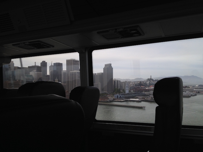
Kasha-Katuwe Tent Rocks National Monument

Desgraciadamente, el tiempo no estaba perfecto ayer pero bastó para no llover y obtener fotos bastante buenas. El monumento se situa al suroeste de Santa Fe, cerco al Cochiti Lake. Si puedo dar un consejo, es ir durante la semana… Había tanta gente que a la entrada solo dejaban entrar un coche por cada coche que salía del monumento. Pero a pesar de la muchedumbre, lo pasamos muy bien y difrutamos del paisaje.
Los Kasha-Katuwe, lo que significa “acantilados blancos” en lenguaje Keresan, son formaciones rocosas que fueron formadas por la erosión. Hace muchos años (6 hasta 7 millones de años) el Jemez Volcano Field depositó capas de cenizas que se pueden ver muy bien en las fotos. Se formaron entonces cañones y los famosos Tent Rocks, que son debidos a la erosión de roca pómez y de toba volcánica debajo de capa de roca.

La visión grandísima de los Americanos... Vista desde el aparcamiento Antes de subir hay que pasar por el cañón Empezando a subir Los Tent Rocks Las capas de diferentes rocas Santa Fe Baldy y Truchas Peaks al fondo ¡Siguiendo niños! Cueva que solía ser una habitación de los pueblos nativos

…and back!

Unfortunately we arrived too late to get a campsite so we didn’t get the chance to sleep within the monument, but we’ve been told that the experience was worth coming back! After the sunset, we drove back to Alamogordo to sleep in a KOA Campground, get some rest and then, early in the morning, go back to the White Sands to see the sunrise!

Instead of coming back on the road 380, we went towards southwest until Las Cruces and then took the I 25 back north to Albuquerque. But of course, not without stopping at some places of interest! About 120km north from Las Cruces, the Interstate crosses a city named Truth or Consequences (also called T or C) and no, it’s not a joke! The spa city was originally named Hot Springs, but that was before a NBC radio program (and later television show) gave his name to the city. T or C has grown around hot springs and is still a very touristic attraction, thanks to the Elephant Butte Reservoir (named like this due to a volcanic core said to have the shape of a lying elephant), where recreationers fish, swim and unwind.

The second and last stop is the Bosque del Apache National Refuge, just before reaching San Antonio. This forest is a green and calm oasis for many migrating species of birds right along the Rio Grande and, therefore, a beautiful place to take a walk and observe nature.

Tired but the head full of beautiful  landscapes, we head up to Albuquerque!

Soaptree yucca Some of those who arrived sooner than we did... White, white, sun! San Augustin Pass, between Alamogordo and Las Cruces, looking East T or C? Elephant Butte Reservoir Endless roads, New Mexico's ID (if not USA's) Silence. Not sure we could notice those if it wasn't for the dead leaves...

To the White Sands National Monument…

New Mexico’s landscape might be desertlike, but nowhere near from uninteresting! There is a lot to see along those 380km that link Albuquerque to the White Sands. Starting from Albuquerque, we took the I-25 down to San Antonio, passing (and stopping) through Socorro. Home of the New Mexico Institute of Mining and Technology, the Karl G. Jansky Very Large Array (a radio astronomy observatory which is part of the National Radio Astronomy Observatory) and one of the hardest golf course in the world (the Elfego Baca Golf Shootout), it even has a M Mountain!

From San Antonio we took the road 380 towards the East; more than 100km driving with only 2-3 ranches on the horizon but passing “next to” the Trinity Site, where the first nuclear weapon was detonated in 1945. Just before reaching Carrizozo, we cross the Malpais Lava flow, which you can clearly see from a satellite view. Finally, we headed south again to Alamogordo and the White Sands National Monument. Nearby, the White Sands Missile Range hosts every year the Bataan Memorial Death March, honouring soldier defending the Philippine Islands during WWII, which brought, this year, 7000 people to the town.

As contradictory as it might sound, the National Monument is sometimes closed to public due to missile tests run by the Holloman Air Force Base situated just next to it! But if it is open and you feel somehow adventurous, there’s a possibility to camp within the monument, but you have to get there early in the day as only 10 primitive campgrounds are available and all taken by latest 1pm!

Socorro means help in Spanish The M Mountain, west of the city Socorro Historic Plaza Towards East on the  Road 380 Approaching the Lava Flow The Carrizozo Malpais Lava Flow Sunset in the White Sands dunes Looking North-West White quietness

Central Avenue (Historic U.S. Route 66)

From Wyoming @ Central all the way down to Downtown… A walk you have to take if you want to feel the American way of advertising! This avenue is a lively street with all possible shops (supermarkets, barber shops, motels, restaurants, cafes, art and clothes stores,…). This street passes through the Old Town, Nob Hill and also links Downtown to the University of New Mexico and is, therefore, used by a great number of commuters and is still considered as the main street of the city.
Three bus lines, two of which are rapid lines, are currently serving this section. People believing in a future for public transports, a new line is being built; the ARTThis line, which will have its own lane except for some sections where it will use mix traffic route, will connect Central @ Unser Transporter Center to Coronado Center or Central @ Tramway. But there is a division of opinion regarding the construction work. Part of the population is pleased that public transport is in full development, but another is afraid that the accessibility to businesses in car and the possibility to park on the sides of the road will affect the economy itself.

New Mexico: Land of Enchantment AND Aliens? Historic Route 66 STOP ART All means are good to attract customers! Jaque Fragua, Ernest Doty and Ryan Montoya (Bomb the Canvas) Frontier - Art gallery restaurant since 1971